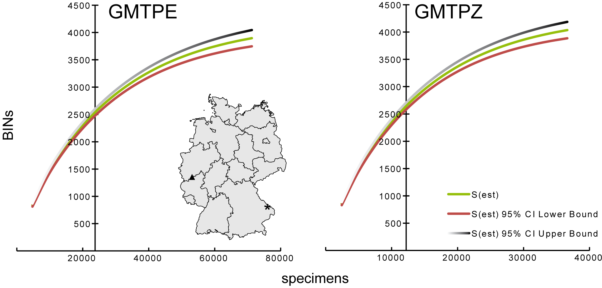
Accumulation curves showing the number of BINs versus the number of specimens analyzed from the two sample locations based on collections from May to September. The map illustrates the location of the two Malaise traps within Germany. Note that the y-axis cuts at the actual number of specimens analysed.
Asterik = GMTPE: Nationalpark Bayerischer Wald
Triangle = GMTPZ: Middle River Rhine Valley