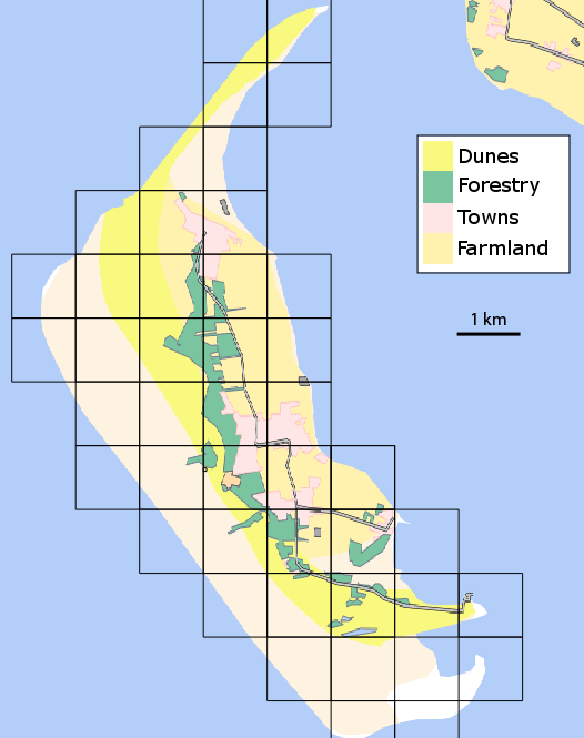
A map of Amrum showing the main landscape features and the 1km2 grid used for the survey. The grid is based upon the spatial reference system EPSG:31467 - DHDN / Gauss-Kruger zone 3.
|
|
||
|
A map of Amrum showing the main landscape features and the 1km2 grid used for the survey. The grid is based upon the spatial reference system EPSG:31467 - DHDN / Gauss-Kruger zone 3. |
||
| Part of: Groom Q (2014) The distribution of the vascular plants on the North Frisian Island, Amrum. Biodiversity Data Journal 2: e1108. https://doi.org/10.3897/BDJ.2.e1108 |