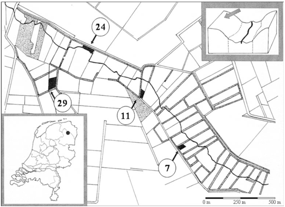
Location of the four grasslands in the valley of Anlooërdiepje in the north-eastern part of the Netherlands (see inset below left). The four black arrows point at the four experimental plots, indicated in black. The numbers in circles indicate the number of years the grassland was taken out of agricultural production at the time of sampling in 1996: plot O (7 years since last fertilisation), plot B (11 years since last fertilisation), plot C (24 years since last fertilisation) and plot K (29 years since last fertilisation). On each grassland, a randomly selected rectangle of 30 m by 15 m served as the sampling plot. See Suppl. material