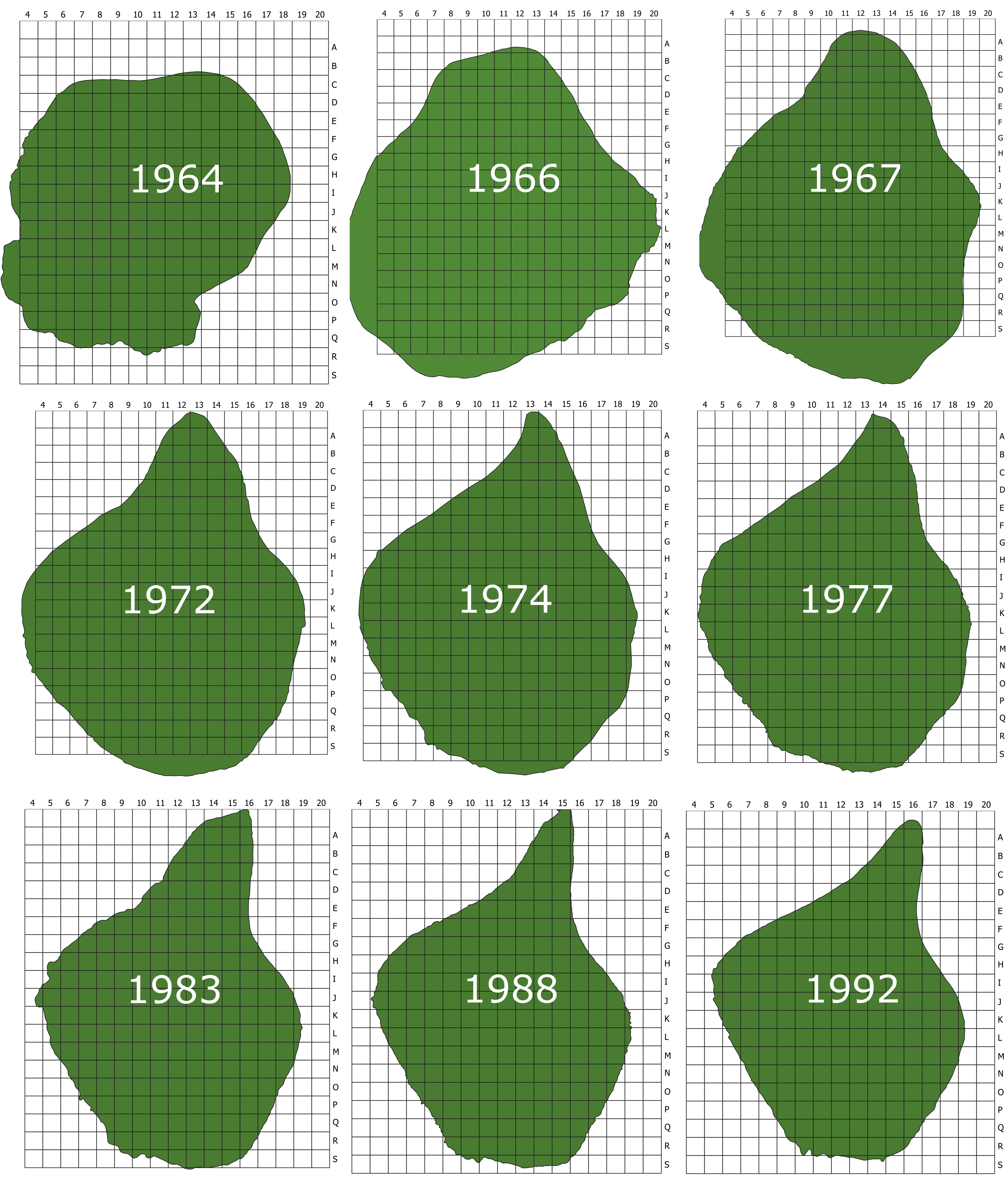
The 1 ha grid used in the mapping of plant distribution on Surtsey and changes of the coastline (caused by coastal erosion) of the island between 1964 and 1992.
|
|
||
|
The 1 ha grid used in the mapping of plant distribution on Surtsey and changes of the coastline (caused by coastal erosion) of the island between 1964 and 1992. |
||
| Part of: Wasowicz P, Thorsteinsson S, Magnússon B, Einarsson E, Bjarnason V, Bjarnason ÁH, Guðmundsson J, Richter SH, Jónasson R, Sveinbjörnsson B, Magnússon SÞ (2020) Vascular plant colonisation of Surtsey Island (1965-1990) - a dataset. Biodiversity Data Journal 8: e54812. https://doi.org/10.3897/BDJ.8.e54812 |