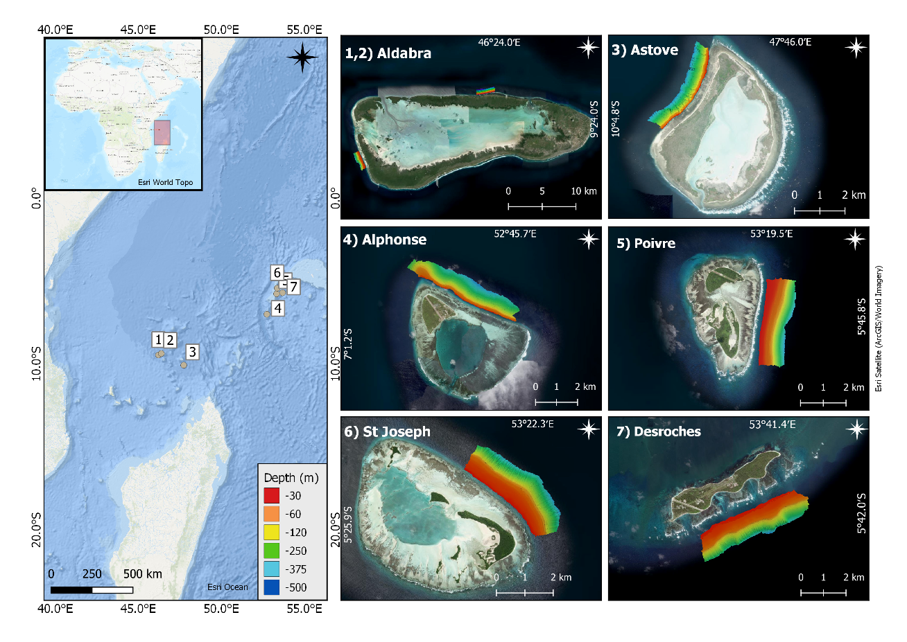
Map of the seven surveyed sites around Seychelles Outer Islands. Multibeam data were overlaid to show survey areas. Sites are listed from west to east.
Survey site mean coordinates:
1) Aldabra West 1 (9°26'50.5284'' S, 46°12'49.3632'' E)
2) Aldabra North 1 (9°21'57.8844'' S, 46°22'43.1148'' E)
3) Astove West 1 (10°4'25.1652'' S, 47°43'58.2024'' E)
4) Alphonse North 1 (6°59'58.1424'' S, 52°43'44.3856'' E)
5) Poivre East 1 (5°45'52.236'' S, 53°19'3.6732'' E)
6) St. Joseph* North 1 (5°25'20.9316'' S, 53°21'30.672'' E)
7) Desroches South 1 (5°41'41.7444'' S, 53°40'35.67'' E)
*St. Joseph was hereafter referred to as D'Arros due to initial naming when compiling datasets and the islands close proximity to one another.
Maps were created in ESRI using the basemaps "World Topographic Map", "Ocean Basemap" and "World Imagery".