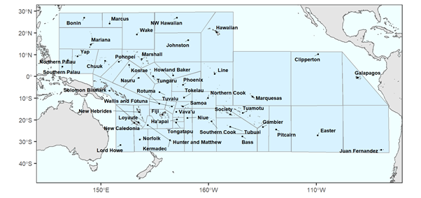
Map showing the boundaries of island groups in the Pacific used in this database. Underlying map: World Coastline for R, based on data from Natural Earth. Polygons surrounding island groups are designed to include all islands in the group using straight lines and, thus, these lines do not correspond to any political border.