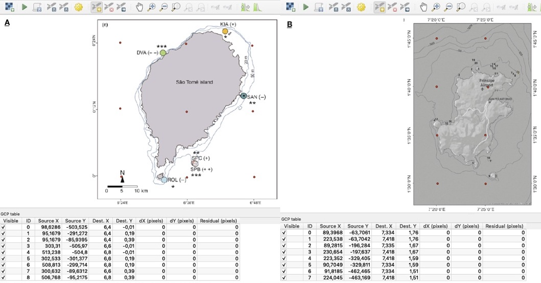
Using the QGIS Georeferencer interface, two raster datasets from literature are used to identify Mangrove habitats: A. the coloured circles and B. the numbers. Red dots indicate raster Ground Control Points.
|
|
||
|
Using the QGIS Georeferencer interface, two raster datasets from literature are used to identify Mangrove habitats: A. the coloured circles and B. the numbers. Red dots indicate raster Ground Control Points. |
||
| Part of: Niza H, Bento M, Lopes LF, Cartaxana A, Correia AM (2021) A picture is worth a thousand words: using digital tools to visualise marine invertebrate diversity data along the coasts of Mozambique and São Tomé & Príncipe. Biodiversity Data Journal 9: e68817. https://doi.org/10.3897/BDJ.9.e68817 |