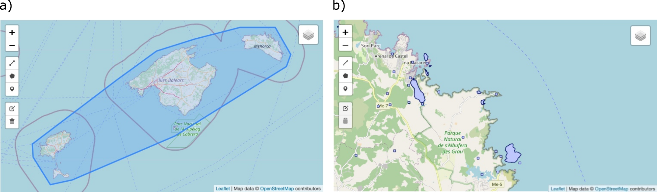
Detail of the map viewer for: a) georeferencing resources and b) site names. The polygon encompassing the georeferencing resource “Nomenclator of Site Names of the Balearic Islands” is shown in a) and a detailed view of the georeferenced site names of the eastern part of the Island of Minorca is shown in b). Tools for zooming and editing can be seen on the left side of the viewer and for layer selection on the top-right corner.