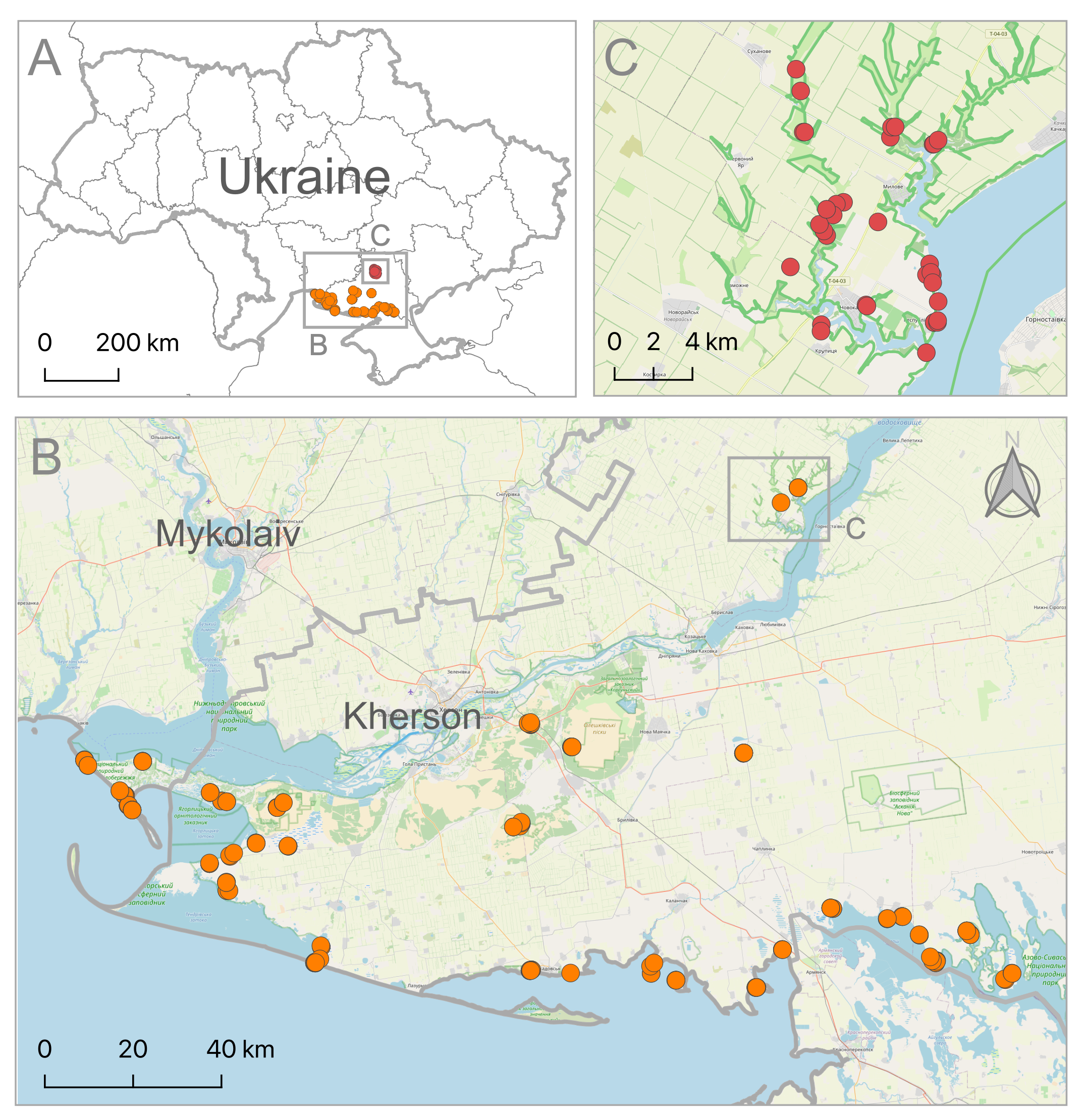
The map of the study region with sampling localities: A map of Ukraine with study area and sampling localities; B sampling localities of the 15th Eurasian Dry Grassland Group (EDGG) Field Workshop in southern Ukraine; C sampling localities of the Dark Diversity Network (DarkDivNet) in the Kamianska Sich National Nature Park. The base map was created using OpenStreetMap data (https://www.openstreetmap.org, as on December 2022).

 
  Part of: Skobel N, Borovyk D, Vynokurov D, Moysiyenko I, Babytskiy A, Bednarska I, Bezsmertna O, Chusova O, Dayneko P, Dengler J, Guarino R, Kalashnik K, Khodosovtsev A, Kolomiychuk V, Kucher O, Kuzemko A, Shapoval V, Umanets O, Zagorodniuk N, Zakharova M, Dembicz I (2023) Biodiversity surveys of grassland and coastal habitats in 2021 as a documentation of pre-war status in southern Ukraine. Biodiversity Data Journal 11: e99605. https://doi.org/10.3897/BDJ.11.e99605