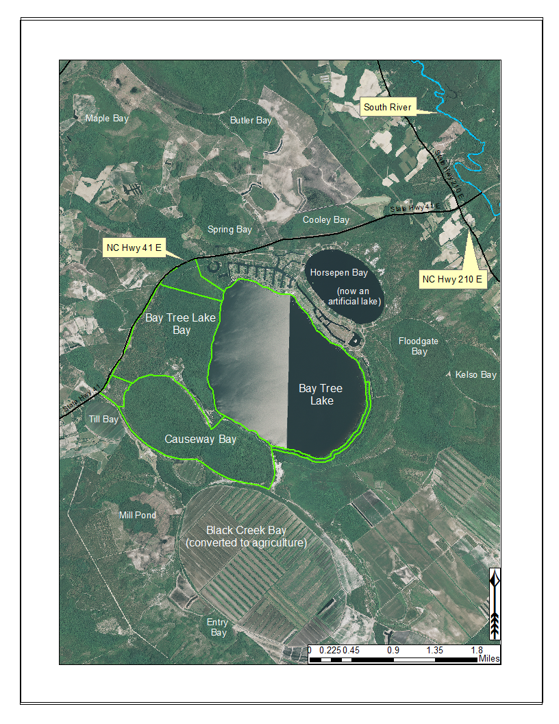
Bay Tree Lake State Park (highlighted in green) and surrounding lands. Lands surrounding Bay Tree Lake State Park to the south are privately owned and have been partially converted to agriculture. Black Creek Bay and several others in the vicinity have been cleared of their original vegetation and converted to agriculture (primarily blueberry farms in this area). Historically, Horsepen Bay was a peat-filled Carolina bay. During the development of the residential community seen along the northeast shoreline (Bay Tree Resorts), it was turned into a body of open water. Aerial imagery, transportation, and hydrography layers obtained from NRCS Geospatial Data Gateway: https://gdg.sc.egov.usda.gov. Map produced by Nathan Howell using ArcGis Desktop: Version 10.2.2. (