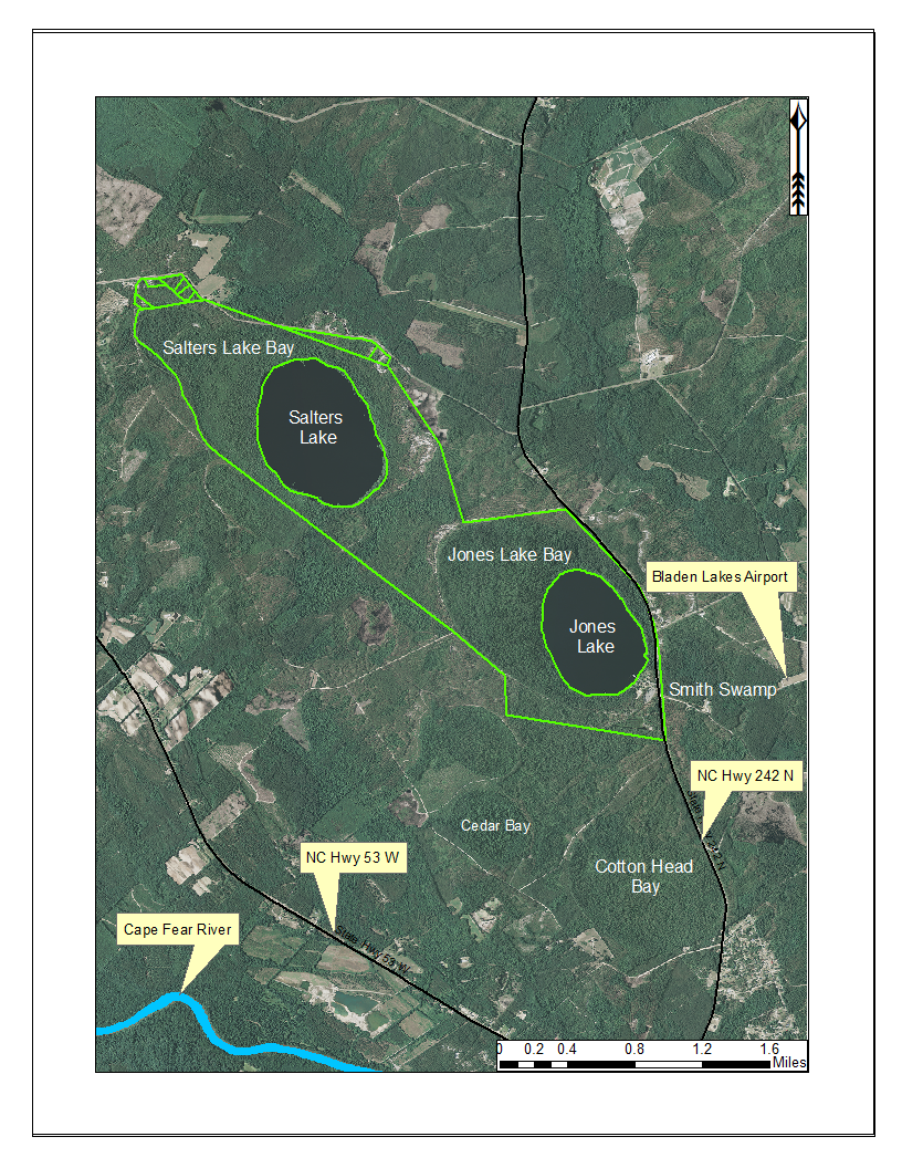
Jones Lake State Park (outlined in green) and surrounding lands. Jones Lake State Park is located between state highways 53 and 242, north of the Cape Fear River. Aerial imagery, transportation, and hydrography layers obtained from NRCS Geospatial Data Gateway: https://gdg.sc.egov.usda.gov. Map produced by Nathan Howell using ArcGis Desktop: Version 10.2.2. (